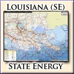
Energy Infrastructure Wall Map of Southeastern Louisiana
Energy Infrastructure Wall Map of Southeastern Louisiana
This wall map is the ultimate visual reference for Southeastern Louisiana's energy infrastructure. It contains all vital information on Oil, Gas, and Electric energy produced and transported through the state, including: pipelines, storage facilities, transmission lines, power plants, and much more.

The most data in the simplest format – this is the most comprehensive (and comprehensible) map you will find in the market. Rextag Strategies’ team of cartographers and designers simplified the information without compromising its quality or quantity. Where applicable, features the following:
-
Labeled Natural Gas, Crude Oil, Refined Products & NGL/LPG/HVL pipelines
-
Labeled Gas Compressor Stations
-
Gas Processing Plants
-
LNG Sites (existing & proposed) including capacity information
-
Natural Gas Storage Facilities
-
Point-location of Crude Oil Refineries & Terminals
-
All types of Electric Power Plants, color-coded by fuel source & sized by capacity
-
High voltage Electricity Transmission lines (115KV & above)
Available State Maps shown in red (links to individual maps at page bottom):

Mapping that is unique to the Energy industry. Nowhere else are such comprehensive & exquisitely detailed maps available by single state. Rextag Strategies' cartographers and designers render these maps on a state-by-state level, enabling them to illustrate on an enlarged and enhanced scale not available anywhere else.
Informing doesn’t have to be boring. Beautifully printed on high quality gloss-photo paper, the wall map contains a system of labels that makes the information highlighted above easy to read and understand:
-
Each pipeline system or transmission line is individually labeled and color coded
-
All gas, oil, & electric sites are represented by a series of easy-to-identify symbols throughout the map
-
The large 36” X 28” print-format allows for greater detail while making it a perfect fit for any cubicle wall
-
The full color and gloss-photo-finish makes the wall map more than a tool of the trade, it makes for a great wall decoration!
Detail-level samples:
.jpg "Rextag Strategies/Hart Energy Pipeline Mapping Products and Services for the Energy Industry")

