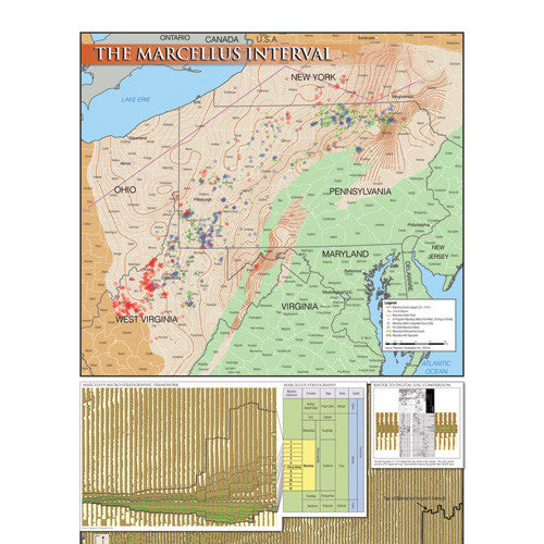
Marcellus Interval Map
The Marcellus Interval map displays the gross isopach of the Marcellus interval, as derived from digital log data. It covers the Marcellus play in eastern Ohio, northern West Virginia, Pennsylvania and southern New York.
The map includes drilled and in-progress Marcellus well locations. Additionally, a regional digital-log cross section displays the internal stratigraphy of the Marcellus and its relationship to underlying and overlying formations.
Laminated Wall Map 18" x 24"