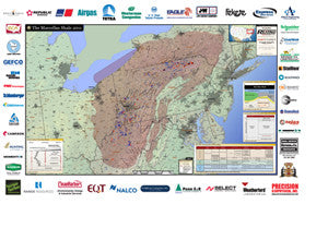
Marcellus Shale Production Map
This deluxe 24" x 36" wall map, laminated to allow dry-erase markers, provides a detailed geographic guide to one of North America's most important shale-gas areas.
Our oversized map shows geology, infrastructure and drilling activity details, such as isopachs, gas pipelines, public lands, county and play-area boundaries. At-a-glance tables provide stratigraphy and cross-section information across the play.
This informative and easy-to-use map helps your team visualize exploration and drilling trends. Order your own copy(ies) today.
